In late September/early October last year Linda and I took a 6-day vacation with our NM family -- son, daughter-in-law, and grandson -- to the Riviera Maya coast of the Yucatan peninsula in Mexico.
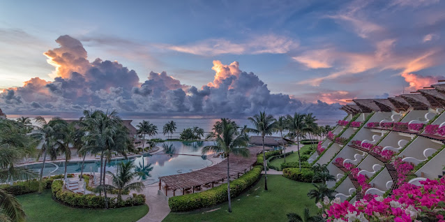
We spent most of our time within the resort area, enjoying the pool, the sun, the food, and our family. In fact, we were practically the only ones there . . . which meant we had the pool (and the poolside service!) mostly to ourselves.
Because we were only about 100 miles away, Linda and I took a day-trip tour to the ancient Mayan city of Chichén Itzá. It was one of the largest cities in the Mayan empire, and at its peak was home to an estimated 35,000 people. It lasted from about 600 CE to about 1200 CE. In 1988 it was designated as a UNESCO World Heritage site.
The Chichén Itzá site is huge: it encompasses about 4 square miles and contains many buildings, large and small. We only toured the area within the circle.
According to Wikipedia, Chichén Itzá is federal property, and the site's stewardship is maintained by Mexico's Instituto Nacional de Antropologia e Historia. The land under the monuments was privately owned until 2010, when it was purchased by the state of Yucatan.
Chichén Itzá hosts over 2 million visitors annually. We arrived about 8:30am and made our way from the parking lot, past the buses, to the entrance and security checkpoint:
Past security you walk a broad dirt path lined with vendors selling souvenirs of all sorts:
Then the vendor path opens up to the main plaza and the iconic landmark, El Castillo (the Spanish name for the Temple of Kukulcán, the Mayan feathered serpent deity similar to the Aztec Quetzalcoatl).
The pyramid stands about 98 feet tall. The sides are about 181 feet at the base and rise at angle of 53 degrees (although this varies a bit for each side). Each of the four faces of the pyramid has a protruding stairway that rises at an angle of 45 degrees. At the base of the balustrades of the northeast staircase (pictured below) are carved heads of a serpent.
To the north and east of El Castillo is the Temple of the Warriors.
The building itself is decorated with gargoyles and bas-relief carvings:
To the south and west of the temple is the Group of the Thousand Columns.
These elaborately decorated columns, while exposed today, would have supported an extensive roof system in the time when the site was inhabited.
In addition to the columns themselves, the stones/bricks in the wall supporting the ground beneath the columns, are decorated with elaborate bas-relief carvings:
To the south and west of the Temple of the Warriors, the columns are at ground level, and you can walk among them on a restricted path:
To the north and west of El Castillo is Tzompantli or Skull Platform, where, presumably, human sacrifices or capital punishment of enemies were carried out.
Here's a closer look at some of the bas-relief sculptures of the wall stones:
West of the Skull Platform is the Grand Ballcourt, one of the largest of the over 1,300 Mesoamerican ballcourts found as far south as Nicaragua and as far north as Arizona at Wupatki National Monument. The ballcourt at Chichén Itzá is 98 feet wide and 317 feet long. (An NFL football field is 160 feet wide and 320 feet long.)
No one is really sure how the ball game was played, and undoubtedly the rules evolved over the hundreds of years for which there is evidence. But most agree that one aspect of the game was putting a large rubber ball -- 10 to 12 inches in diameter, and weighing 3 to 6 pounds -- through a ring affixed 20 feet high on each side wall of the court.
If you would like more information about the ballcourts, click here; if you want more about the game itself and its cultural significance, click here.
At the southeast end of the ballcourt is the Lower Temple of the Jaguar (tall structure in the picture below). Note the head of the serpent at the end of the long side wall of the ballcourt.
Here's another view of the Lower Temple from outside the ballcourt:
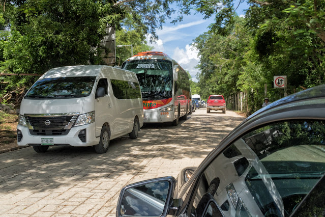
By 10:30am, more cars and buses were streaming in as we left the parking area.
The day was hot and humid, and by this time we were soaked with sweat, so we needed some relief. Our tour included a visit to a nearby cenote -- a giant sinkhole filled with groundwater -- where we could go for a swim in the cool underground water.
The northern Yucatan peninsula is primarily limestone, dolomite, and other porous sedimentary rocks. As a result, the peninsula has no lakes, ponds, or rivers. Instead, tropical rainwater percolates into the ground and forms underground rivers and pools which occasionally become accessible when the limestone bedrock collapses, opening to the surface.
There are over 6,000 cenotes in Yucatan. Some cenotes are very small; others are quite large. The Mayans relied on cenotes for their fresh water, and there are at least four large sinkholes in the Chichén Itzá complex . . . the largest of which (the Cenote Sagrado) is 60 meters in diameter.
The cenote we visited was not in the Chichén Itzá complex, but was included in a spa-like facility.
The roped off area was a restricted space to allow for a rope swing and drop into the water:
We changed into our swimsuits, descended a long switchback of concrete stairs dimly lit by bare lightbulbs, grabbed our life jackets, and walked down a shorter set of concrete stairs into the pool.
 |
| This is not us. |
I mentioned life jackets. The cenote bottom is many meters below the surface, so to ensure that no one drowns, everyone must wear a vest. We were happy to do so, and hung out with the fish (yes, there were fish in the pool!) for 10-15 minutes.
Fully refreshed, we hopped back in the car and drove a few miles to the town of Valladolid, where we had lunch at a local (real Mexican!) restaurant across a broad plaza from the Convento San Bernardino de Siena.
Built between 1552 and 1560, the building was headquarters for the Franciscan order's efforts to convert the Mayan population to Christianity.
For lunch we had probably the biggest chile relleno I've ever seen and a plateful of huge chicken tacos:
Well fed, we rode back to our hotel on the coast.
If you would like to see these images in a larger format, please visit my photography website, Todos Juntos Photography, by clicking here.
Enjoy!


