Thursday, March 9, 2023

Utah Photo Adventure, Part 4 - Mars Desert

  (NOTE: This is the fourth in a series of posts about a photography trip I took in early November, 2022.)


A few miles east of Factory Butte and Moonscape Overlook is yet another barren basin of sand and rock.  


The landscape looks somewhat like that of Mars -- no vegetation, flat plains filled with rocky debris, surrounded by multicolored hills. 


Fittingly, the area is home to the Mars Desert Research Station, a private, space-analog facility that supports Earth-based research in pursuit of the technology, operations, and science required for human space exploration.  


It is owned and operated by the Mars Society, a space advocacy organization dedicated to the human exploration and settlement of Mars.  The station sits on land leased from the State of Utah, and does not permit visitors (or drones).


We made our first visit to the area on the same overcast day that began at Moonscape Overlook.  Not a great day for photography . . .


We returned the next morning for sunrise, and were rewarded with much better light, colors, and shadows.  Blue Hour wasn't great, but Golden Hour was good.


Frankly, it looked like a giant garbage dump for rocks, from the smallest . . .


. . . to the largest . . .


See Alan in that little space under the big rock?


and everything in between -- all shapes, sizes, and colors jumbled together:


(Do the rocks in the upper left corner look like two alligators having sex?)


And what should we see peeking over the valley rim as we departed the Mars Desert?


If you would like to see these images in a larger format, please visit my photography website, Todos Juntos Photography, by clicking here.


Enjoy!


Thursday, March 2, 2023

Utah Photo Adventure, Part 3 - Aerial Views

  (NOTE: This is the third in a series of posts about a photography trip I took in early November, 2022.)


In hopes of getting some interesting and unusual views of the landscape, I brought my little drone along on this trip.  Here are some images taken from above the foothills of Factory Butte and above the Moonscape Overlook valley.


Factory Butte


First, for a one-minute video giving you a 360-degree aerial view of the landscape around Factory Butte, click here.


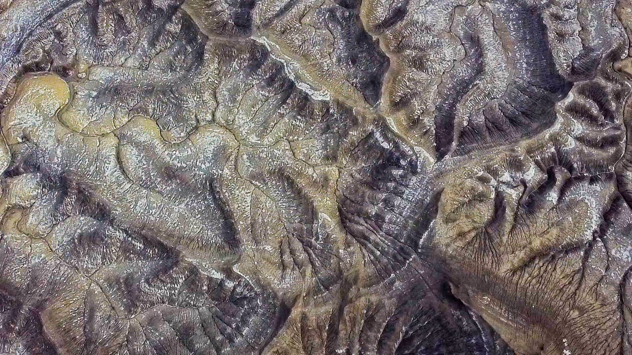
Now looking straight down at the rock you saw in the video:


Here's another overhead view of the area:


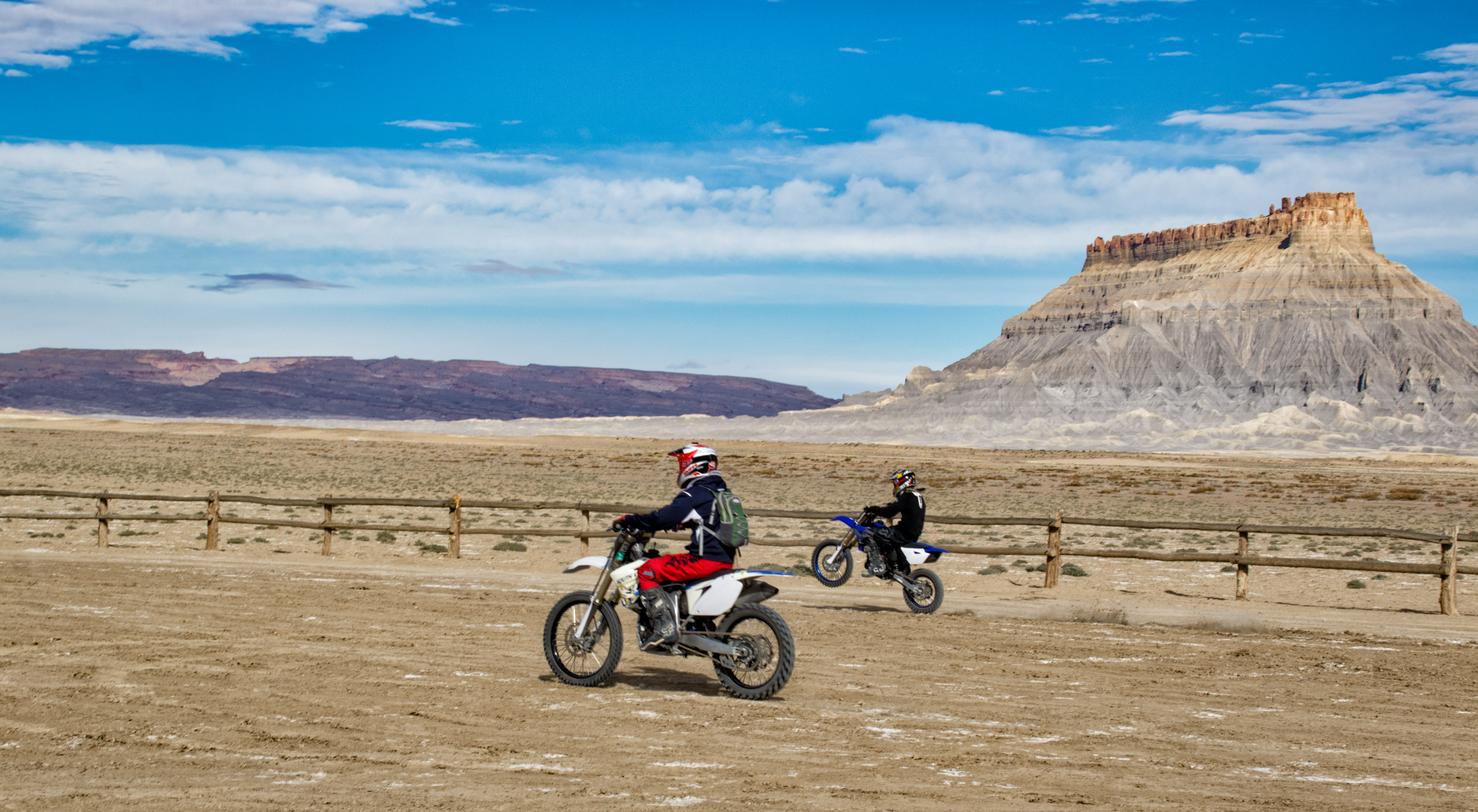
The tracks you see in the two images above (and others) are from dirt bikes like these which ride all over the area:


Additional views of the foothills:


Some of these made good black-and-white images, highlighting the textures in the hills:


Moonscape Overlook


The view from high above the plateau on which I was standing, and the valley below the cliffs:


Mountains in the background above are the Henry Mountains, which I will show more of in a future post.


Looking straight down:


And then looking out over the valley:


If you would like to see these and other aerial views in a larger format, please visit my photography website, Todos Juntos Photography, by clicking here.


Enjoy!


Wednesday, February 22, 2023

Utah Photo Adventure, Part 2 - Moonscape Overlook

 (NOTE: This is the second in a series of posts about a photography trip I took in early November, 2022.)


A couple of miles east of Factory Butte, the plateau from which it rises suddenly ends.  At the edge of this plateau is Moonscape Overlook.  Steep cliffs descend into a broad valley filled with strange colorful shapes and water courses.


We visited this overlook three times:  once in the late afternoon (as in the photo above) and twice at dawn.  On the latter two visits we had bright sunshine one morning and total overcast the other.


I brought my drone along, but was only able to use it on the afternoon visit, due to unfavorable wind conditions on the morning visits.  I'll share those images in a later post devoted solely to my drone photography.  But being on the edge of the cliffs about 1,000 feet above the valley floor was almost like having a drone in my hands.


By the way, all the white stuff you see on the features in the valley isn't snow -- it's gypsum, deposited from ocean water that covered this area millions of years ago.  Here's a closer look:


Using my longer lens, the view from the top of the cliffs revealed all the strange shapes and textures that wouldn't be obvious at ground level.  Here are two examples from the afternoon visit:


The next morning brought us a dramatic sunrise . . .


and gorgeous light on the valley features, bringing out the many colors of the landscape:


The next morning (our third visit), the sky was completely overcast, so no chance for the brilliant colors of the day before.  Instead, before the sun rose, we got some great "Blue Hour" images:


Eventually the sun rose high enough to brighten the clouds and overwhelm the beautiful blue light . . .


. . . so we moved on to explore other areas.


If you would like to see these images (and more) in a larger format, please visit my photography website, Todos Juntos Photography, by clicking here.


Enjoy!