Tuesday, July 19, 2022

South-Central New Mexico Church Tour, Day 2


This is an account of Day 2 of our photography tour of village churches in south-central New Mexico.  You can read about Day 1 in the post below this one or by clicking here.


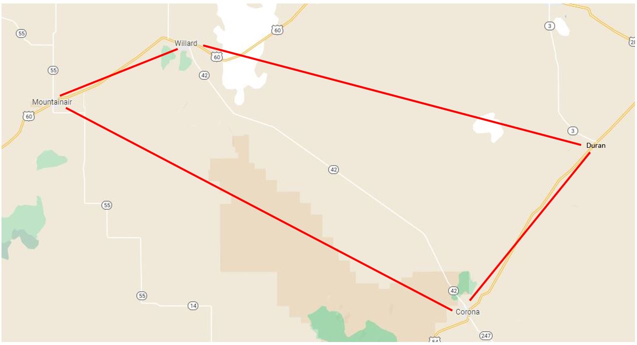
Here's a map of the five villages northwest of TorC that we visited on Day 2.


After overnighting in Truth or Consequences, NM, our first stop on this day was Cuchillo, NM (pop. approx. 35).  Cuchillo was settled in the late 1800s, and its San Jose church was built in 1907.


One of our party investigated the outdoor confessional.


Right next door to the church was a sign and other icons in a more fundamentalist vein:


From Cuchillo we traveled west to the eastern edge of the Gila National Forest to visit the almost-ghost town of Chloride.


Chloride began as a tent city boom town in 1880 when silver was discovered in the canyons and mountains to the west.  At its peak, Chloride had a population of about 3,000 -- mostly hard working, hard drinking miners.  There were nine saloons, three general stores, a hotel, an assay office, and a red-light district . . . but no church.


Chloride survived the Panic of 1893, but by 1900 the ore had been exhausted and the town became a quiet little village.  Population today is about 20, with some descendants of original settlers.


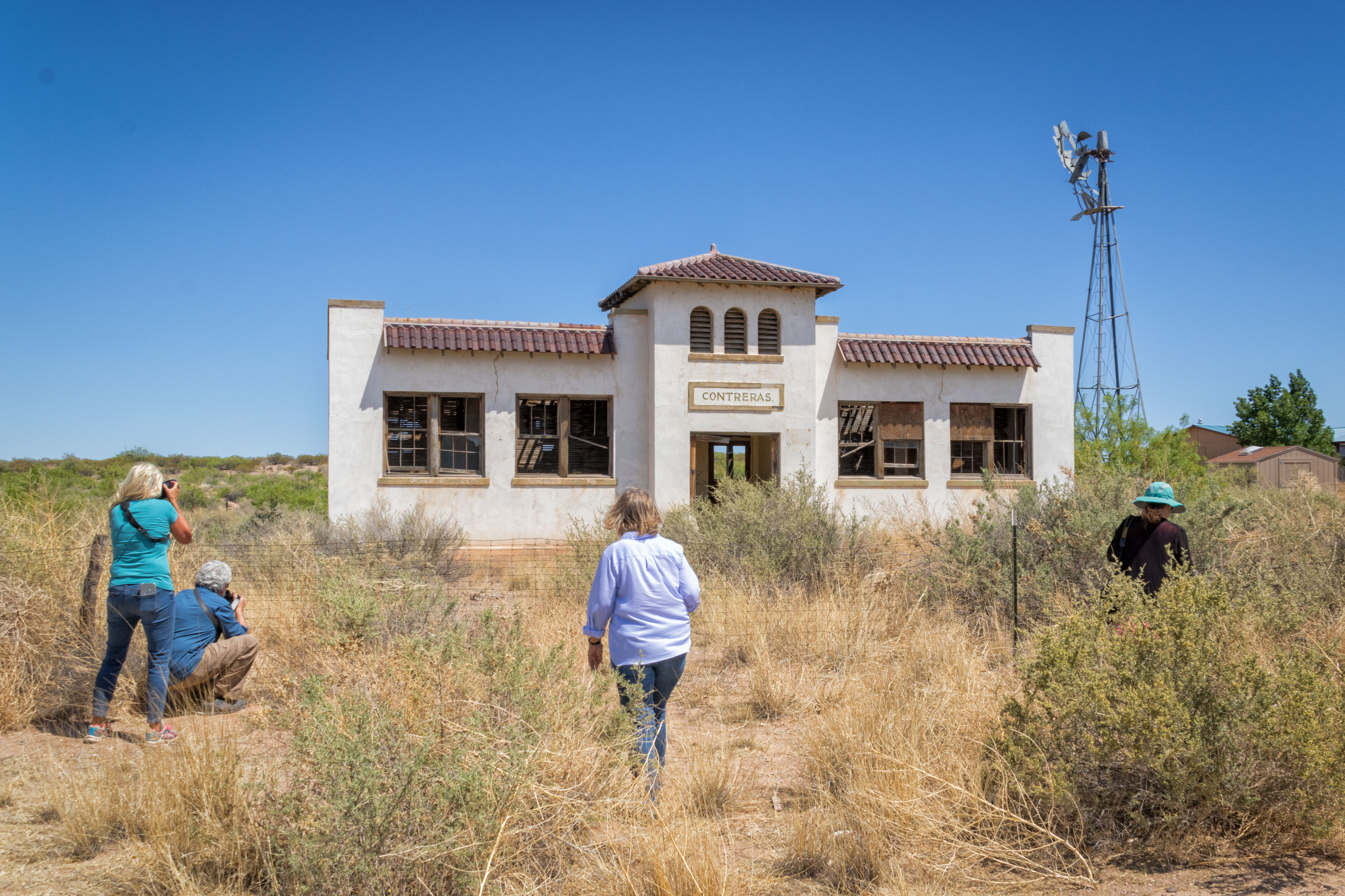
One of the original buildings -- the Pioneer Store -- has been converted to a museum housing all manner of artifacts from the early days of Chloride.


We were able to look around for about an hour inside the museum.


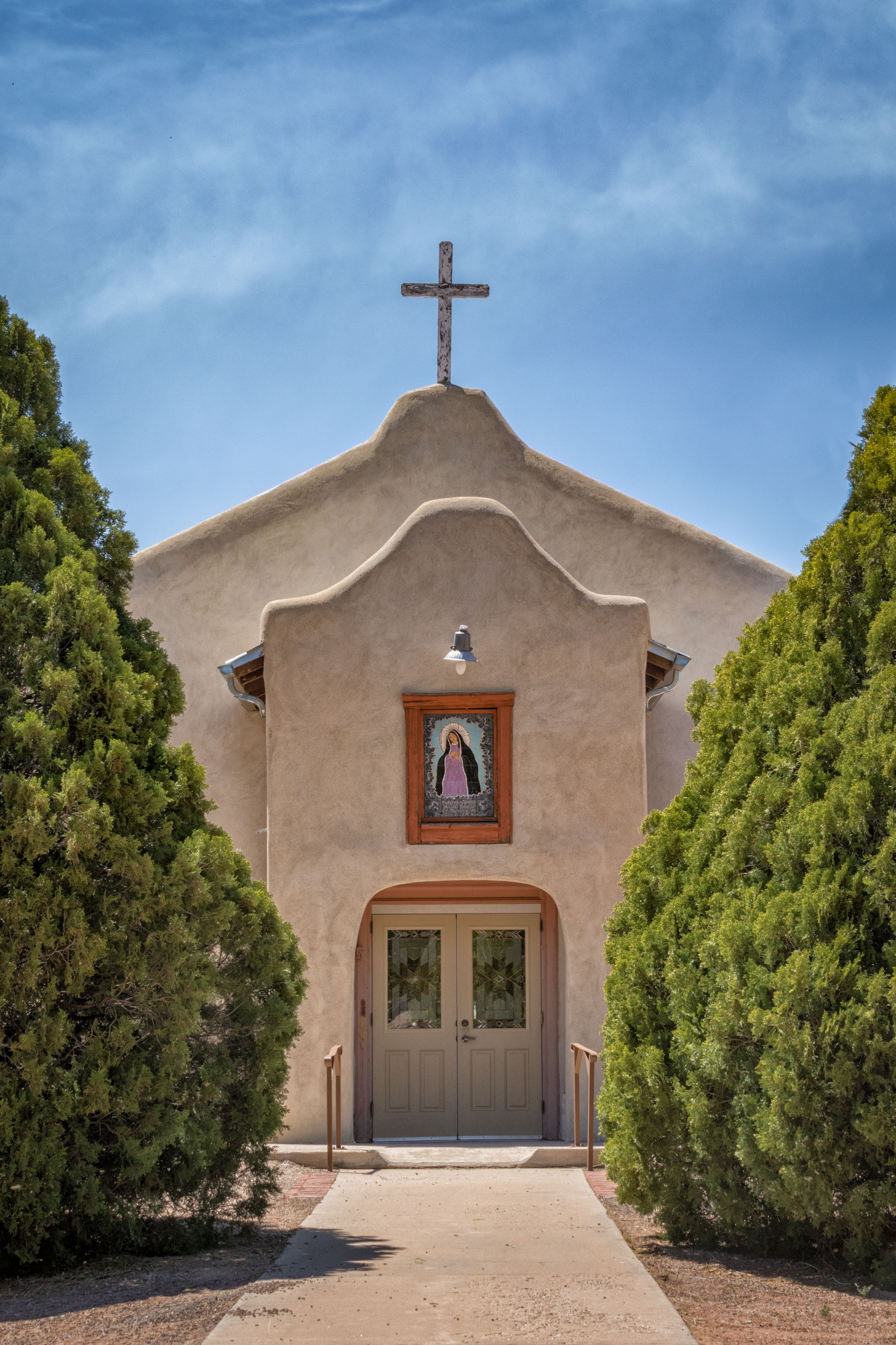
From Chloride we backtracked 2.5 miles to Winston.  Like Chloride, Winston was originally a mining town, founded a year after Chloride by miners who thought Chloride was "too rowdy."  But after the Panic of 1893 Winston evolved into a farming community, population 64 in 2020 census.  Accordingly, its St. Jude Mission church is small, but clean and well cared-for; the interior is filled with religious icons.


Next stop was Placita (not to be confused with Placitas, NM, north of Albuquerque).  The village was founded in the 1840s primarily for farming and ranching in Cottonwood Canyon where water was available.  (Any time you see cottonwood trees in New Mexico, you know there's a source of water nearby.)  Population in 2020 was recorded as 576.


According to some accounts, Placita was founded in the 1840s by the Sedillo family.  The San Lorenzo Catholic church, similar in style to the church in Cuchillo, was built in 1916.


We were able to enter this church and look around.


Two miles up the road from Placita, our last stop before lunch was Monticello, NM (pop. 84).  Founded by farmers and ranchers in Cottonwood Canyon in 1856, its San Ignacio church was built in 1867.  These days Monticello is known for its organic farms.


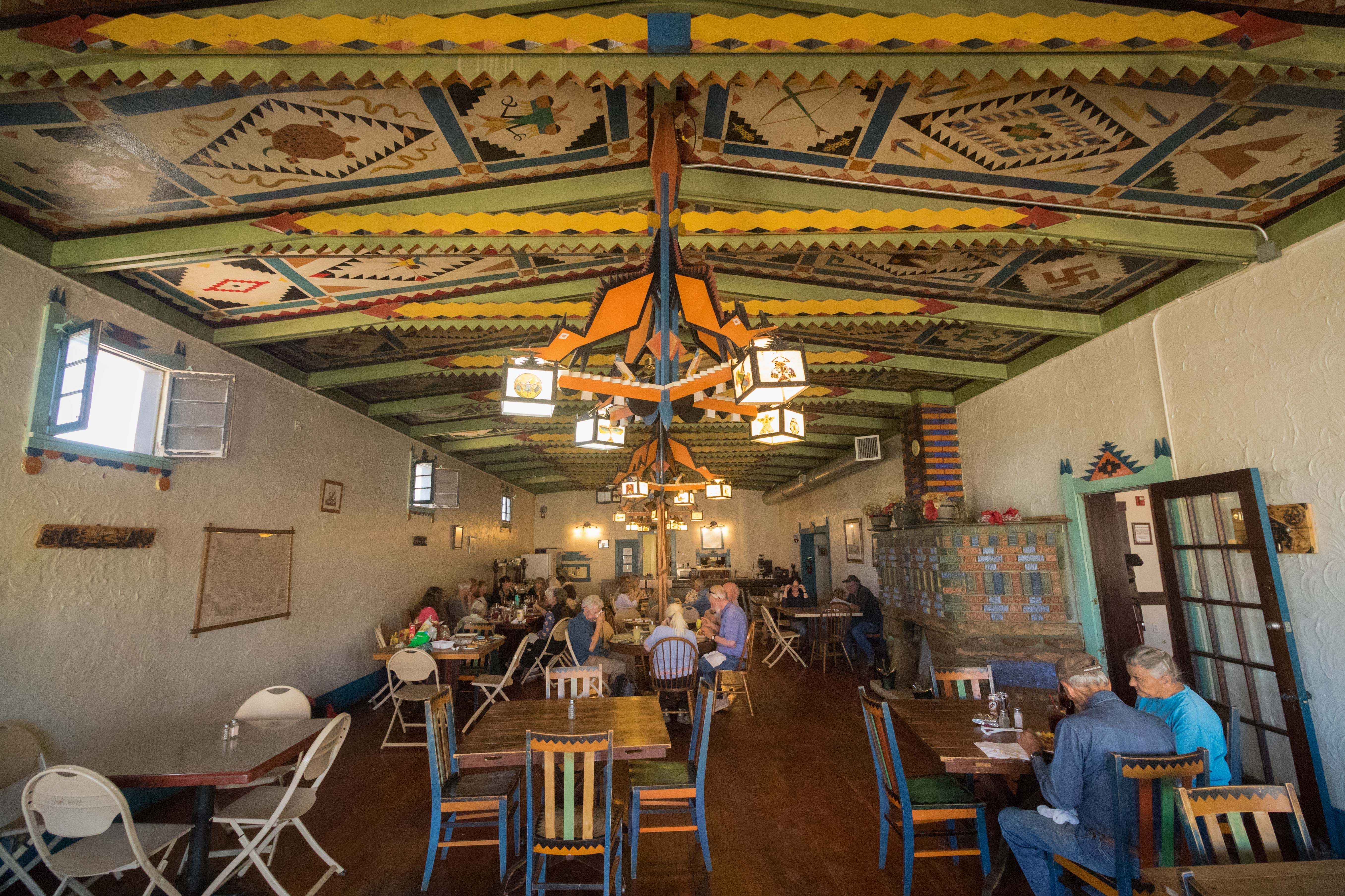
There were half a dozen more churches on the tour, but three of them I had photographed previously, and I knew they were best photographed in morning light, not afternoon.  In addition, my traveling companion, Alan, and I were "shot out" (meaning we were out of enthusiasm for photographing anything!), so after a delicious lunch of green chile cheeseburgers at the Buckhorn Cafe in San Antonio, NM, we headed for home.  We'll shoot those other churches another time.


If you would like to see these images in a larger format, please visit my photography website, Todos Juntos Photography, by clicking here.


Enjoy!


Monday, July 11, 2022

South-Central New Mexico Church Tour, Day 1


In May I went with a group of photographers on a two-day trip to visit and photograph churches in small towns in south-central New Mexico between Albuquerque and Truth or Consequences.  The trip was organized by the Corrales Arts Center, and planned and led by Mark Werner, Dennis Chamberlain, and Lynda Chamberlain.


In addition to the churches, along the way we spotted a few abandoned gas stations, an abandoned school building, and a museum filled with artifacts from the almost-ghost town of Chloride, NM (no church there, though).  And we learned some New Mexico history, too!


This post is an account of the first day of the trip; the second day's adventures will be recounted in a separate post.  Here's a map of our Day 1 route.


Our first stop was Iglesia de San Isidro on NM 337 between Ten Points and Chilili, southeast of Albuquerque.  


San Isidro is the patron saint of farmers, so there are a lot of San Isidro or San Ysidro churches scattered about New Mexico . . . including one in the village of Corrales where I live.


Many of the churches also feature a shrine to the Virgin Mary on or near the church grounds.  Here are a few we saw along the way:


There was even one -- a specific version, the Virgin of Guadalupe, commemorating an appearance of the Virgin Mary in Guadalupe, Mexico, in 1531 -- carved out of (into?) the trunk of a dead tree:


A few miles down the road our next stop was the village of Chilili and its San Juan Nepomuceno church which featured a really unattractive front portal:


Fortunately, there was a nice gateway arch I could use to block out most of the portal structure and still get a glimpse of the church:


The church was built in 1841, 71 years before New Mexico statehood, in honor of John of Nepomuk (1340 - 1393), who was born in Bohemia.  According to a mural on the back outside wall of the church building . . .


Nepomuk (Nepomuceno) was tortured and martyred for refusing to reveal the confession of Queen Sophia of Bavaria to her husband, King Wenceslas IV . . . preserving the confidentiality of the confessional (for which he was canonized in 1729) and, in a way, preserving a woman's right to privacy.


The land on which the church sits is supposedly protected by the Treaty of Guadalupe Hidalgo (1848) which ended the Mexican-American War and ceded Mexican territory (including what is now New Mexico) to the United States.


Interestingly, however, if you check the treaty itself, there is no "Sect. 5" in Article 2, and nothing in Article 2 relates to preservation of land rights . . . frontier legend, I guess.


Across the street from the church we photographers also gravitated to an abandoned gas station -- the first of three we saw:


Continuing south on NM 337, then turning west onto NM 55, we came to the San Antonio church of Tajique.


Next stop . . . Our Lady of Sorrows in Manzano, built in 1829.


Our next stop was the San Vicente de Paul Catholic church in Punte de Agua, established in 1878.


And across the highway was another abandoned gas station!


Our last stop before lunch was the oldest church on the tour:  Quarai Mission Church, one of the three structures in the Salinas Mission National Monument.


The church and related buildings were constructed between 1627 and 1632, but were abandoned in 1678 due to a combination of disease, drought, famine, and raids by indigenous Apache people.  You can read more about Quarai and the other two mission churches in the vicinity by clicking here.


From Quarai we motored on into Mountainair, NM, to eat lunch at the Shaffer Hotel dining room decorated in what might be diplomatically called "Pueblo Deco."


The hotel and restaurant were built in 1923, and have been opened and closed multiple times over the past 99 years.  Fortunately for us, for now they're back in business.  You can read more about the hotel's origins in J.M. House's "City of Dust" blog by clicking here.


And right across the street from the hotel, there was another abandoned gas station/garage, complete with a vintage 1954 Chrysler New Yorker Deluxe parked in front.


After lunch we headed southwest to the villages of Contreras and La Joya.


In Contreras we photographed the tidy, well-kept church, as well as an empty old adobe house nearby and an abandoned school building on the main road:


In the village of La Joya, the Our Lady of Sorrows church was undergoing repairs, but was still available for photographs.  Following my "walk around the teacup" strategy, I shot it from a few different angles.


And there was even a joyful Jesus tree carving reminiscent of the "Touchdown Jesus" at one end of the Notre Dame football stadium.


From La Joya we hopped on I-25 and went south to the village of San Acacia to see the abandoned and overgrown Chapel of St. Acacius.


This was the only church we were able to enter on the first day of the tour (other than the Quarai Mission church).


Our last stop for the day was the Sagrada Familia church in Lemitar, NM.


By this time in the afternoon, the wind had picked up and everyone was tired, so we skipped the San Miguel Mission church in Socorro (which looks a lot like the Lemitar church) and headed for our hotel and dinner in Truth or Consequences, NM.


If you would like to see these images (and a few others) in a larger format, please visit my photography website, Todos Juntos Photography, by clicking here.


Enjoy!


Friday, July 1, 2022

April Serendipity Ramble


Occasionally my friend, Bruce Shah, and I just hop in the car and see what we can find out in the rural reaches of New Mexico.


Back in April we lit out for an area in east-central New Mexico bounded by Mountainair, Willard, Duran, and Corona, primarily along NM highway 42 (southeast of Albuquerque; see map below).


Our first stop was Mountainair Cemetery, about a mile west of town, which neither of us had visited previously and wasn't easy to find (not on a main road).  Similar to many rural New Mexico cemeteries, it held a few interesting gravesites and memorials:


Then we headed east to Willard (where we had photographed its cemetery on an earlier trip -- click here to see images from that one), and turned southeast onto NM 42.


About where that little "42" symbol is in the middle of the map above we found what's left of a town called Cedarvale, a farming community founded in 1908.  The town basically emptied out during the Depression, but before it disappeared, the WPA built a school that's still there (now abandoned).


At the Cedarvale school we left Highway 42 and drove northeast  along unpaved county roads to find the now-overgrown Cedarvale Cemetery . . .


. . . and the still-tended Pinos Wells Cemetery (which my friend, Alan Postelnek, and I visited a few years ago) out in the grassy, relatively treeless ranchlands.


As you might be able to tell from the flag, the wind was blowing about 30-40 mph.  That made it a good day for the wind turbine farms in the area . . .


. . . but it also meant dust was blowing everywhere:


We cruised into the small village of Duran (pop. approx. 35) where there are still a few old buildings, including San Juan Bautista church and a general store/hotel building owned by Anton Coury who was murdered in the building by robbers in 1921.


Photo courtesy of J.M. House's blog, "City of Dust"


You can read more about the history of Duran by clicking here.

From Duran we drove down Highway 54 to the town of Corona, where we stopped for lunch at the El Corral Cafe, a classic small-town New Mexico restaurant . . .


. . . complete with a poster for one of New Mexico's favorite flavors:


By the way, Corona was the town closest to the site of the crash of an unidentified device (weather balloon? flying saucer?) 75 years ago on July 3, 1947.  Roswell, NM, gets credit for the UFO because the U.S. Army Air Corps scooped up the debris and took it to Roswell Army Air Field 80 miles away from the crash site.

Having reached the limit of our excursion, we turned around and headed back up Highway 42 to Willard, where we took a little detour northeast on Highway 60 to chase the dust clouds and found this bleak scene:


Then we drove back to Mountainair and made a pit stop at Abo, one of three Salinas Pueblo Missions National Monument sites.  Abo was built in the mid-1600s.  You can read more about it here.


We returned to Albuquerque in late afternoon -- a good day's journey.

If you would like to see these images in a larger format, please visit my photography website, Todos Juntos Photography, by clicking here.

Enjoy!