
A few weeks ago my friend, Alan, and I explored an area of the Lybrook Badlands that we had never been to. The Lybrook Badlands are in the same general vicinity as Georgia O'Keeffe's "Black Place." They are a hodge-podge of mesa cliffs, arroyos, round hills of Mancos shale (like Black Place), rocky debris, and a scattering of hoodoos.
Alan and I have explored parts of the Lybrook Badlands on a couple of earlier trips; you can read about one of them here. This time we were on the hunt for an area with a high concentration of hoodoos (rare in Lybrook) that we had read about online. There was a trail in the AllTrails database, so we set out to follow it to Hoodooville.
From our research on sunlight direction, we wanted to get there for early morning light, so we left my house about 4:15am and arrived at the start of the trail map about 7:00am just as the sun was coming up over a distant mesa. That location was at the end of a couple of miles of two-track, and also happened to be the site of an oil drilling rig -- of which there are many scattered throughout the Lybrook area.
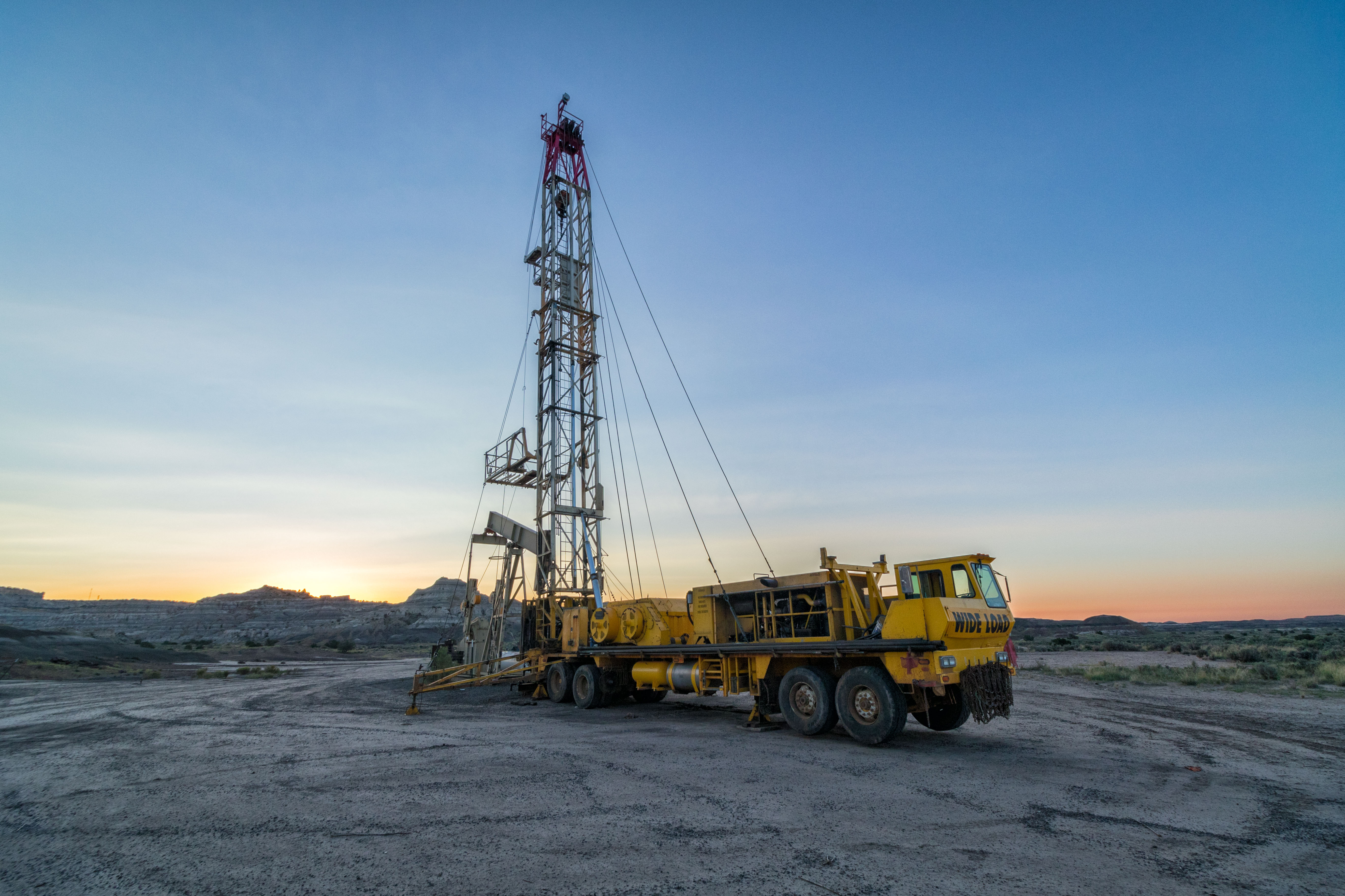 |
| This is not a hoodoo. |
As the sun rose, the cliffs of a nearby east-facing mesa were bathed in beautiful "golden hour" light.

There was no marked or visible path, so we followed the AllTrails trail on a tablet up a narrow watercourse between hills of Mancos shale until we reached a very steep hill. The trail map did not show the terrain, but at that point it looked on the tablet as if the trail went straight up that hill. Yikes!
We couldn't believe that was right so we tried going around the hill. The live GPS signal showed us we were veering off the trail, so we tried going around the hill the other way. Again the GPS showed us going off the trail, but we kept climbing, figuring there must be an easier way.
We were wrong.

It soon became clear that the trail to Hoodooville was up at the top of the cliffs you see in the picture above. Still we thought we could find a way up that wasn't as steep as the hill we avoided. Here's the path we ultimately took:
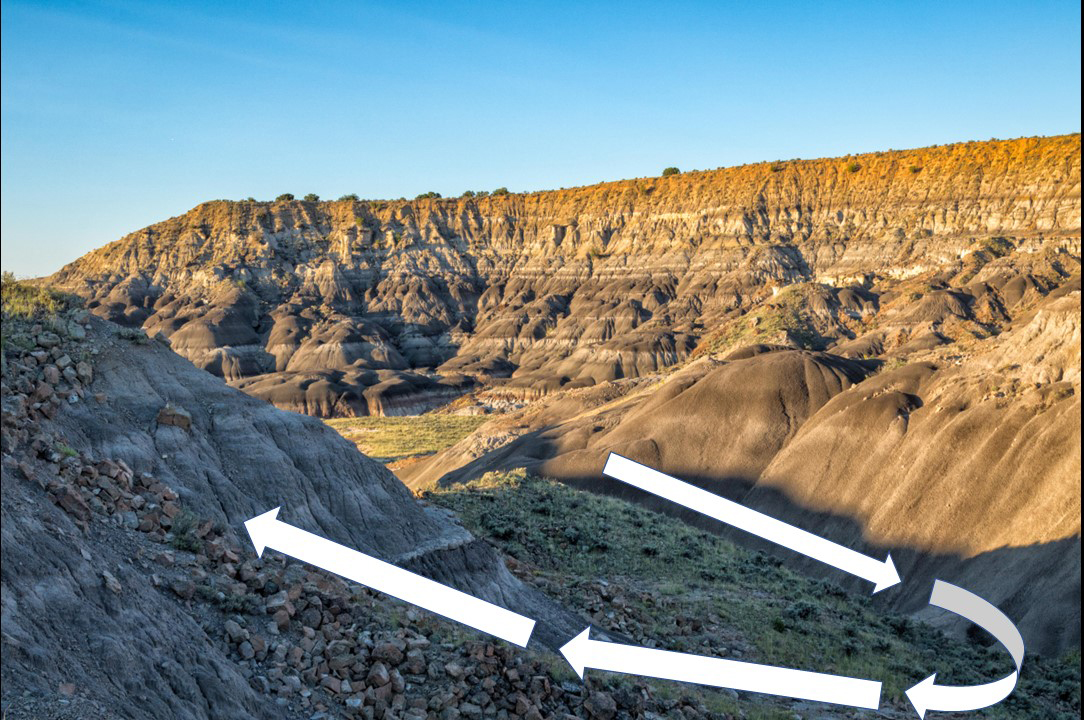
From below, looking upward, here's what our option looked like:

Those rocks are about half the size of standard cinder blocks, and they were piled loosely on top of each other, so the footing was treacherous. To climb, we had to bear walk on all fours all the way up. Alan waited below and off to the side of the rocky area until I got to the top, to avoid any rocks I might dislodge. The original route up that steep hill would have been easier . . and safer!
Finally, we made it to the upper level and got back on the trail to Hoodooville.

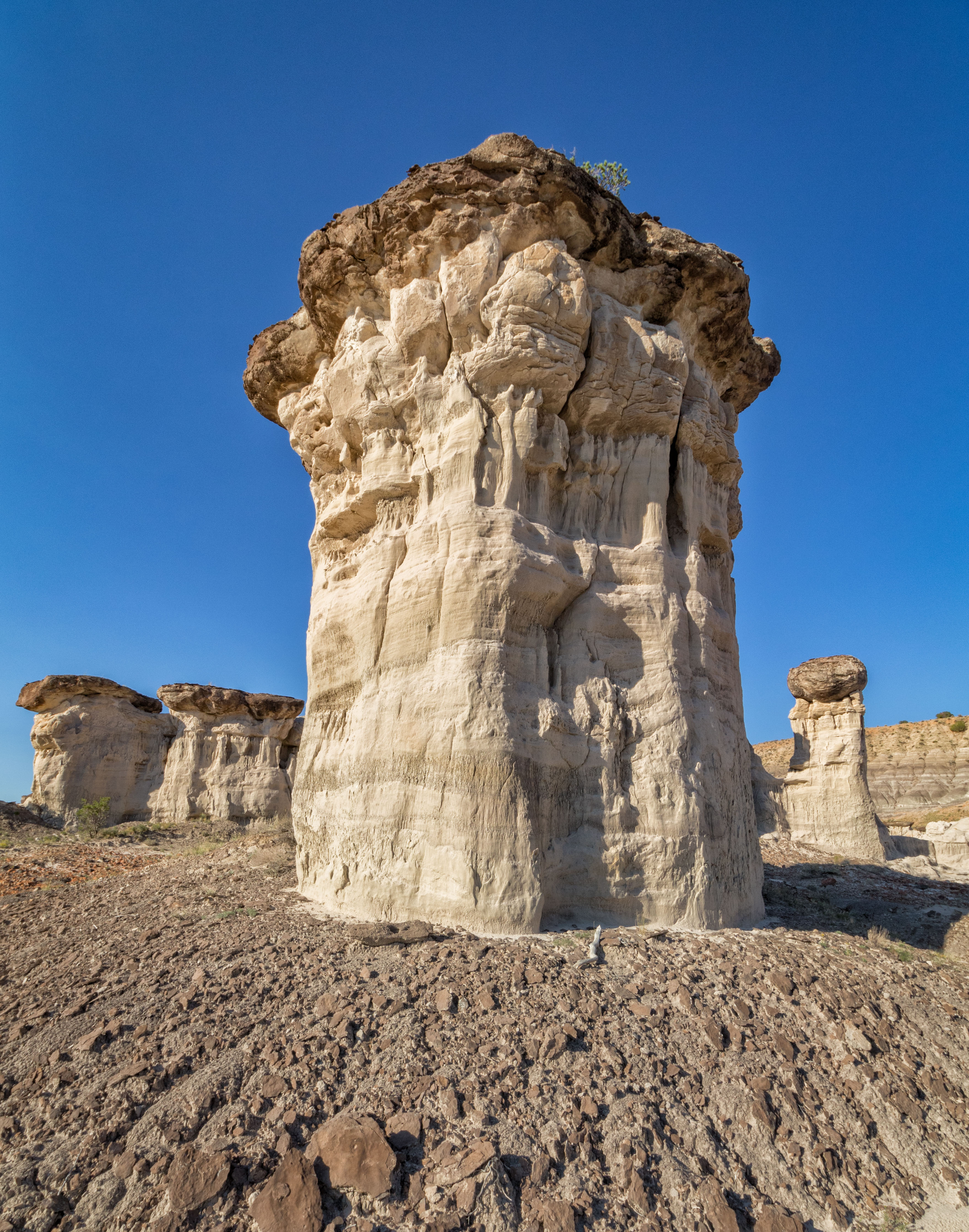
The first hoodoo we encountered was a massive rock atop a short column of mudstone:

For scale, here's a view with Alan in the frame:
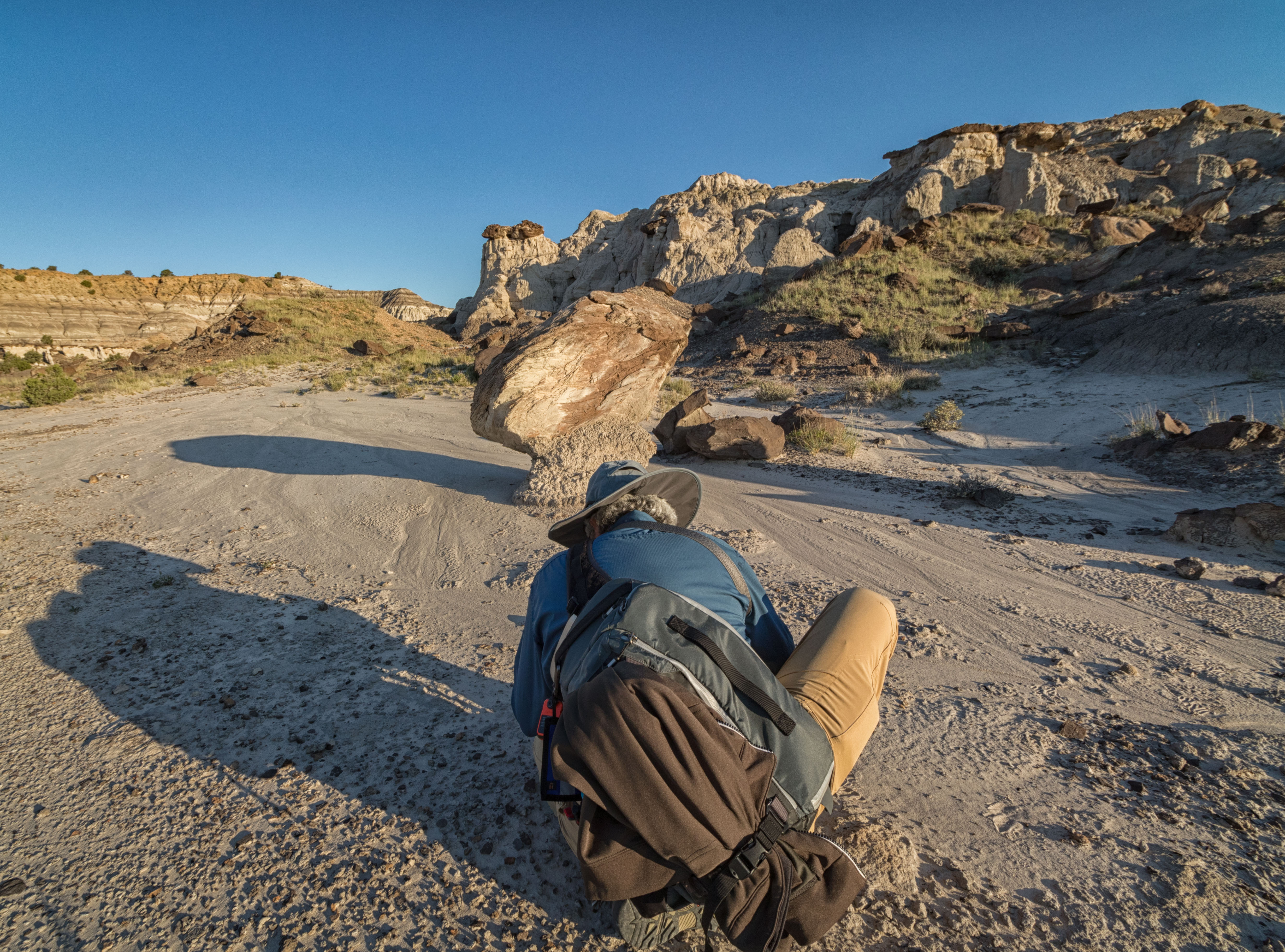
Most amazing, however, was the shape of the rock and how it was supported by that small column. I can't believe it hasn't already fallen!

A hundred yards or so further on, another hoodoo appeared, looking like a giant hockey puck, or a cookie, on a pedestal at the edge of a cliff:

A bit further on we found another hoodoo precariously perched like the first one:

But the biggest and best were yet to come:


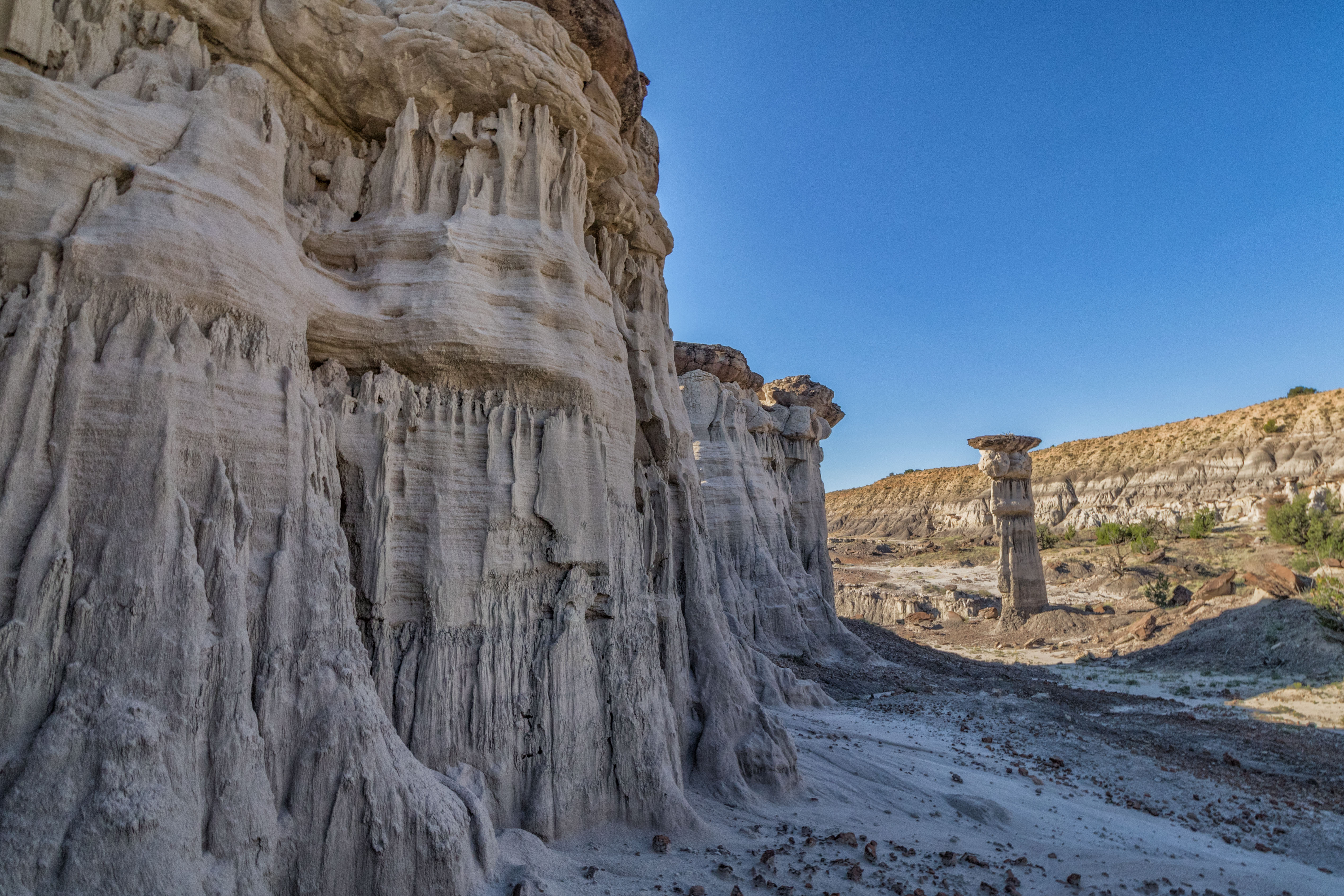
These hoodoos are not like the smaller, more graceful mushroom-style hoodoos of Ah-Shi-Sle-Pah. These are giant slabs of mudstone topped by huge boulders of slate and shale. There were even a few that looked like flying saucers:

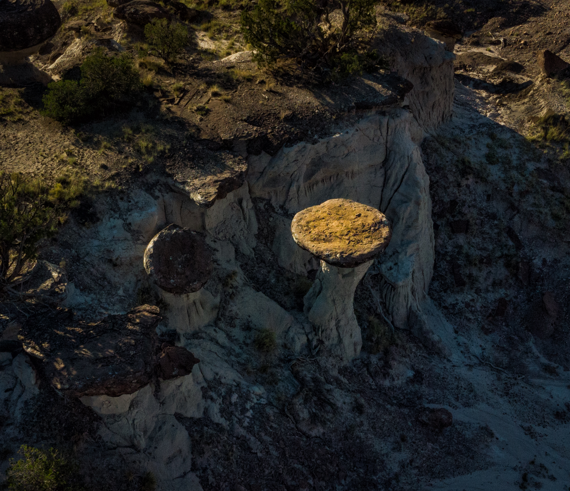
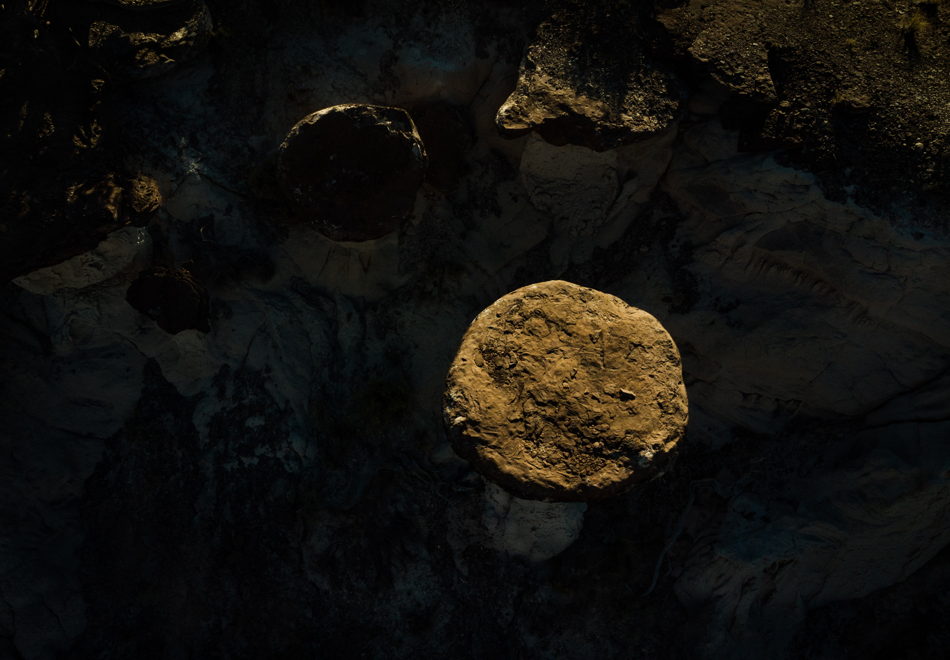
Speaking of flying . . . I had brought my drone along to get some aerial views of the hoodoos and the mesa and valley below us.

Here's a portion of Hoodooville from above:


And here are some individual hoodoos from the ground and the air:


Eventually we had to make our way back down to the valley and the car. We decided not to go down the way we came up, so we followed the AllTrails map back to that steep hill that intimidated us from the bottom. Here's what it looked like heading down:

We drove back to Corrales, stopping for a delicious breakfast at Bobby and Margie's Cuban Cafe in Cuba, NM.

After a long, early morning of driving, hiking, and climbing, there's nothing like a hearty breakfast of hashbrowns, scrambled eggs, and chorizo -- the New Mexico version of corned beef hash.

If you would like to see these and other images in a larger format, please visit my photography website, Todos Juntos Photography, by clicking here.
Enjoy!
Great photos of these very unique structures - one of the shots from the drone looks like a New Mexico Stonehenge. / Barry
ReplyDelete