
During "monsoon season" in New Mexico, rain doesn't come out of a layer of stratus clouds blanketing the sky from horizon to horizon. It usually comes from large isolated cells of turbulent clouds that move blindly across the landscape.
Occasionally those storm cells crash (slowly) into each other, creating more random turbulence and, if the light is right, some dramatic visuals. Last Saturday evening was one of those times.
Two cells were involved: one rising to the southeast above the Sandia Mountains . . .

. . . the other moving from the northwest toward the mountains.

Here's a map showing the relative locations of the cloud cells. My location is the red pin. Ignore the circle with the star in it.

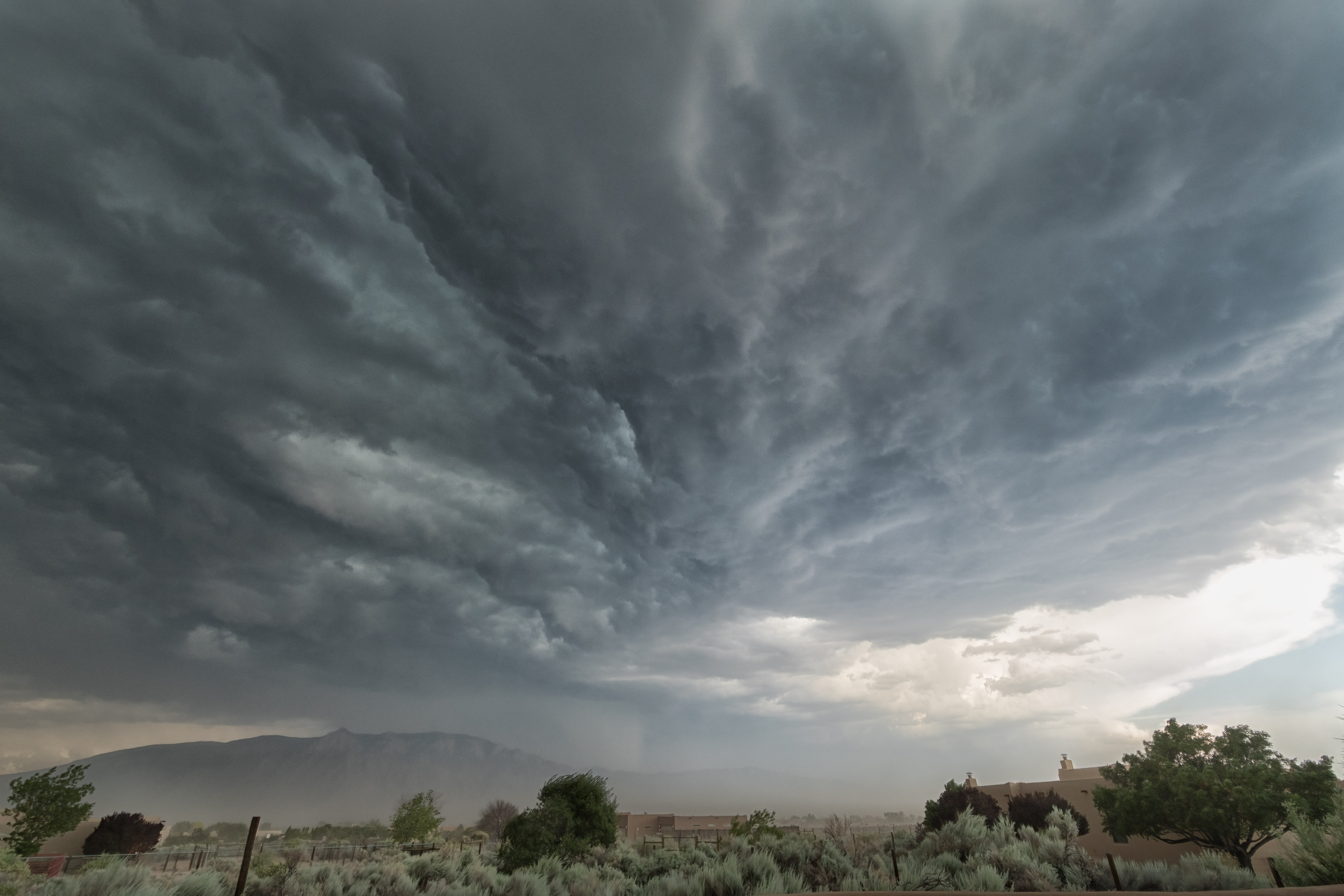
The dark cell from the northwest moving toward the white cell in the southeast extended a long "finger" of clouds ahead of the core of the cell. Here's what it looked like from my back patio:
 |
| View looking northwest |
 |
| View looking southeast |
As the cloud "finger" passed nearby, you could see the turbulence in the clouds . . . and below the clouds (behind the house) there's rain coming down. The two images below were made about 5 minutes apart.


Looking back toward the northwest from my driveway (on the front side of my house), here comes the rest of the storm cell:

And notice the flag in the image above (lower right corner). The wind was blowing pretty hard at this point.
In a few minutes, the dark northwestern cell was crashing (slowly) into the white cloud cell over the mountains, as you can see in the image below:
At this point, it started to rain, and we went out to eat dinner. When we returned about an hour later, the trailing edge of the northwest cloud cell was approaching, creating a gap between the cloud and the horizon where the setting sun could illuminate the scene.

Ten miles to the southeast, however, the sun wasn't low enough yet, so the clouds and mountains in shadow looked like this:

The trailing edge of the northwest cell kept moving east and the sun fell closer to the horizon, eventually illuminating the clouds piled up above the mountains.


You'll notice the weird light (above and below). After rain, the northwest cell brought lots of smoke . . . apparently from wildfires in southwestern Colorado. You can see it in the haze at the horizon.


By now, the white cloud cell over the mountains has been completely obscured -- or maybe subsumed or destroyed -- by the northwest cell. Here's a wider view looking ESE:

After the sun fell below the horizon, the light on the eastern scene faded, and those orange clouds turned gray:

But the show wasn't quite over yet. The trailing edge of the northwest cell overhead was now being illuminated from below by the sun that, from the ground, was below the horizon.

A few minutes later, it was all over.
If you would like to see these images in a larger format, please visit my photography website, Todos Juntos Photography, by clicking here.
Enjoy!
I think the beauty and free show of the summer clouds is too often taken for granted. Well done Weather dog. / barry
ReplyDelete